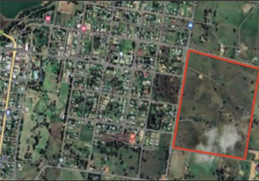
A substantial Development Application to turn a residential subdivision of four lots into 128 in Boorowa’s Long Street was put towards Hilltops Council during their September 23 meeting this year.
The proposed development is set to be between 96-148 Long Street Boorowa and would include new roads, tree removal and various other infrastructure works. The additional housing available in Boorowa will almost certainly progress the town forward, bringing more accessible and affordable housing options to the local market, in a town which has lacked options in the past.
The Boorowa Residential Subdivision has so far received support from the community, with all written submissions to Council in favour of the Development Application. The development is proposed to be in stages as follows: • Stage 1 – creation of 57 Residential lots, 2 Drainage Reserves, new roads and associated infrastructure works; • Stage 2 – creation of 30 residential lots, new roads and centrally located stormwater detention basin and community open space; • Stage 3 – creation of 21 residential lots, new roads and Public Reserve; • Stage 4 – creation of 19 residential lots, new road, 1 stormwater detention basin and Public Reserve. “The report was presented to Council for determination as the application has received forty-two (42) submissions during the public notification period and as a result, cannot be determined under Delegated Authority. Notwithstanding, all forty-two (42) submissions were in support of the development,”
Hilltops Council stated in their business paper report. “The subject site is located approximately 1.4 kilometres east of the Boorowa Central Business District and is zoned R1 General Residential under the Boorowa Local Environmental Plan 2012 (LEP). There are no mapped constraints on the site except for an area of high biodiversity in accordance with the LEP. “The land is a combined title area of approximately 44.31 hectares.
The topography is considered undulating with the high point of the site being located at the southern boundary at RL 547 metres AHD, and the lowest point is at the north-western corner of the site at approximately RL 500 metres AHD. The site currently drains to Long Street and Rye Park Road. There is an existing water supply reservoir (Council owned) adjacent the site to the south on Tip Road. “The site has been mostly cleared of vegetation for agricultural purposes, except for a number of native paddock trees located throughout the site and road frontages.
The proposed development requires the unavoidable removal of native vegetation to a level that triggers the provisions of the Biodiversity Conservation Act 2016 and as such, a Biodiversity Development Assessment Report (BDAR) has been included within the submitted material.” Overall, it seems like the proposed Development will do wonders for the town of Boorowa going forward.
Tim Warren


